(First published June 2016, last updated July 2025)
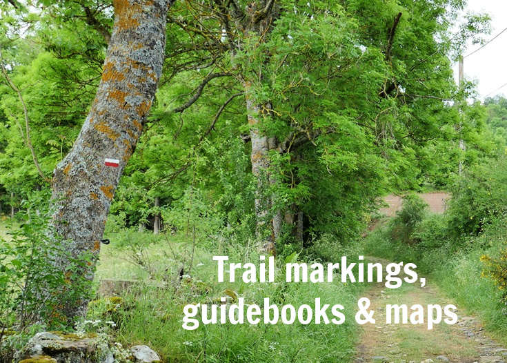
Trail markings, GR paths, GRP paths and PR paths
Walking is almost a national pastime in France and tens of thousands of kilometres of paths criss-cross the country.
This network of trails is overseen by the Fédération Française de la Randonnée Pédestre (FFRP), the non-profit organisation which, along with hundreds of dedicated volunteers, maintains all walking paths in France.
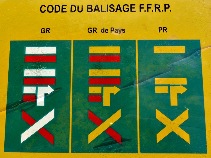 Long distance paths, or Grands Randonnées, are referred to as GR paths and use a system of red and white trail markings, or blazes, to mark the way.
Shorter paths, confined to one region of France, are known as Sentier de Grand Randonnée de Pays or GRP trails and use red and yellow trail markings.
Local trails known as Sentier de Promenade et Randonnée or PR trails use single yellow stripes or, where there are multiple paths, multiple colours are used.
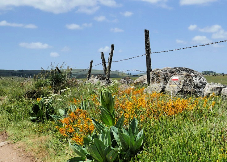
Red and white stripes indicating the GR 65 are painted on a rock on the Aubrac plains
The blazes are self-explanatory depicting left turns, right turns and wrong way. And once you find the start of the trail, it’s a simple matter of looking out for the red and white blazes that keep you headed in the right direction.
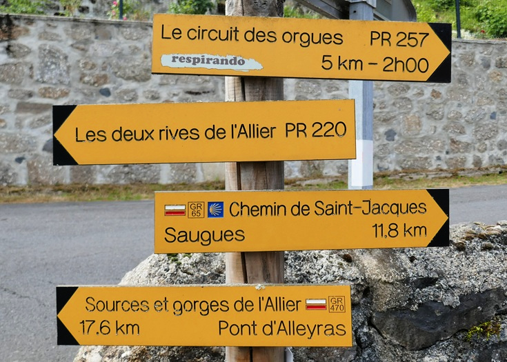
In Monistrol-d’Allier, the PR 257, PR 220, GR 65 and GR470 intersect and head off in different directions
GR paths are well-marked wherever there is a fork or other deviation but there will not always be a blaze or marking in sight. Keep your eyes open and look out for markings in unusual places—on trees, houses, fences and kerbs.
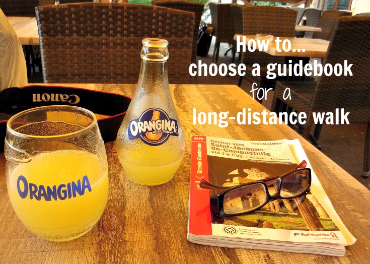
Choosing a guidebook
You’ll find a range of guidebooks available for many of the most-loved walks in France, all providing various levels of detail on the route, the villages you’ll pass through and the distances between them.
My personal favourites are the TopoGuides published by the FFRP and if there is a TopoGuide published for my walk, you can be sure there will be a copy in my backpack!
Inside the TopoGuide, you’ll find the path marked on a series of topographic maps, providing a clear visual understanding of the terrain and the proximity of the path to the nearest road. Many times, this has allowed me to detour off a muddy track in heavy rain or to see where a detour might avoid…you know, that one hill too many
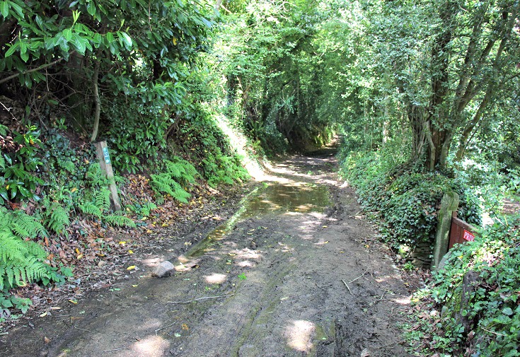
Muddy track on the GR 341S in Brittany
Miam Miam Dodo guidebooks are another popular choice among walkers. Although I’m a devoted TopoGuide girl myself, what appeals to me may not appeal to you. When I walked the GR 70 Chemin de Stevenson in 2016, I carried both and put together a comparison of the TopoGuide and Miam Miam Dodo guidebook, along with some tips for reading topographic maps.
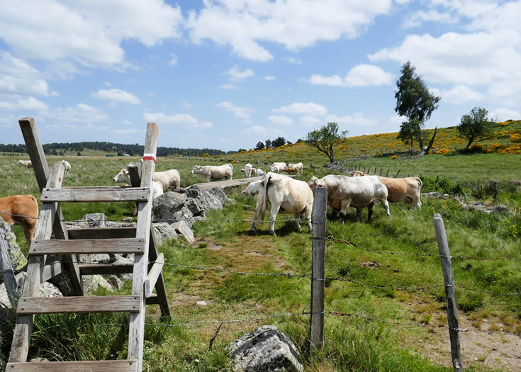
Clear markings on the gate indicate the path continues through the cow paddock
IGN maps
The topographic maps found in the TopoGuides are based on the Series Bleu (1:25,000 scale) maps produced by the Institut Géographique National (IGN). These maps provide a lot of detail, including topographical contours, villages, rivers and the GR paths. They do not extend to street level but provide more than enough detail to guide you safely each day.
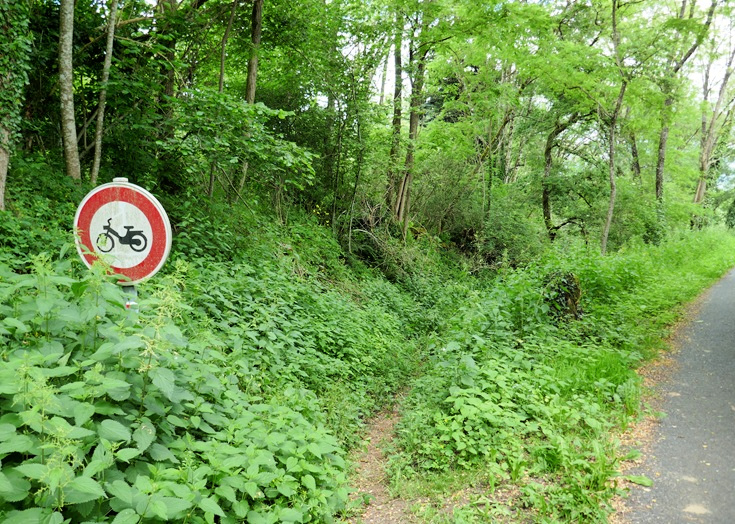
Occasionally, trail markings become hidden by overgrown vegetation, in this case, the red and white stripes are barely visible below the bicycle sign. Having access to a map reminds you to keep an eye peeled whenever you expect the path to veer away.
If there is no TopoGuide available, paper copies of the maps can be purchased in most major towns and often in the local tabac, however, the paper maps that you’ll find in the local store are often out of date, not reflecting recent changes to the path.
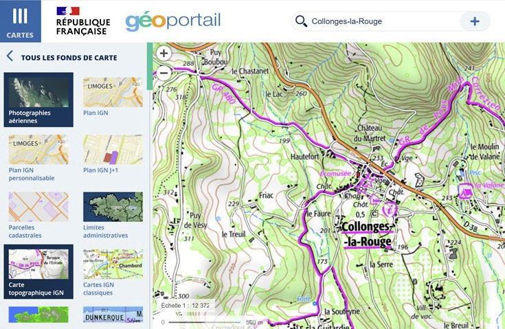
A more reliable approach is to view the IGN maps online on the GéoPortail website (which is also available from the free Cartes IGN app for your phone). On your laptop, choose the Carte topographique IGN option from the CARTES menu in the top left corner and enter the name of the town into the search field. Zoom in and follow the path (clearly marked in purple) from one village to the next. You’ll find tips for reading a topographic map at the bottom of this post.
As you walk, it is possible to track your location using the GPS tracker on your mobile phone with the Iphigénie app (a paid subscription service available for both Android and Apple phones) which uses the IGN maps as a base.
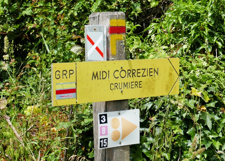
This sign near Turenne advises walkers following the GRP Midi-Corrèzien to turn right. The red and white cross advises walkers following the GR 46 not to turn right
In 2024, I returned to the Martel to Rocamadour walk, but instead of following the GR paths exclusively, I looked for local paths and other alternative routes to join all the villages I wished to visit. I found the Cartes IGN and Iphigénie apps accurate and easy to use, and invaluable for reconnecting me with the GR path.
If you do venture off the GR path in search of a shortcut, make your safety a priority and consider these tips for walking safely and considerately.
Practical tips for long-distance walking—preparation, packing and avoiding blisters