(Published June 2016, last updated July 2025)
Every now and then while walking the Chemin de Saint-Jacques, I’ll meet a fellow walker who set out that morning trusting they’d find a camp site for the night, and has only a vague idea of where they’ll stop tomorrow. While I envy them that freedom and flexibility, I know that will not be a stress-free and enjoyable experience for me.
Freedom, for me, means starting my walk knowing that I never have to worry about finding a bed and my only job for the day is to walk, and enjoy the sunshine (hopefully) and the scenery (definitely)!
As you plan your walk, remember that there are no set stages and you are free to walk as far or as little each day as you wish. Guidebooks (mine included) are often organised around a list of villages or towns but there is no advantage or obligation to follow these suggestions if the distances do not suit you.
If your preference, or a dodgy knee, dictates that no more than ten kilometres (six miles) each day is best for you, listen to your intuition and plan accordingly. On the other hand, if you know you can comfortably walk 25 or more kilometres (15 miles) each day, plan a more strenuous schedule that meets your needs.
To plan an itinerary I need to know two things—
(1) What the terrain is like—is it hilly, flat—so that I can estimate how far to walk each day.
(2) Where I’ll find accommodation.
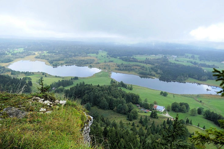
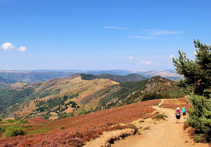
The climb up the ridge above Lac des Mortes on the Échappée Jurassienne is tiring, but the view from the top is well worth the effort
What is the terrain like?
I find the easiest way to get all the information I need about the terrain is to buy the TopoGuide. Produced by the FFRandonnée (part of the Fédération Française de la Randonnée Pédestre (FFRP) which maintains all long-distance walking paths in France), the TopoGuide shows the path overlaid on a topographic map with all roads and villages clearly marked. This allows me to see at a glance which days will be hilly and should perhaps be a little shorter. Distances between villages or other landmarks are given, allowing me to work out where I’ll be after walking 15, 20 or 25 kilometres. (You’ll find more details about the information included in the TopoGuide in this post on choosing a guidebook.)
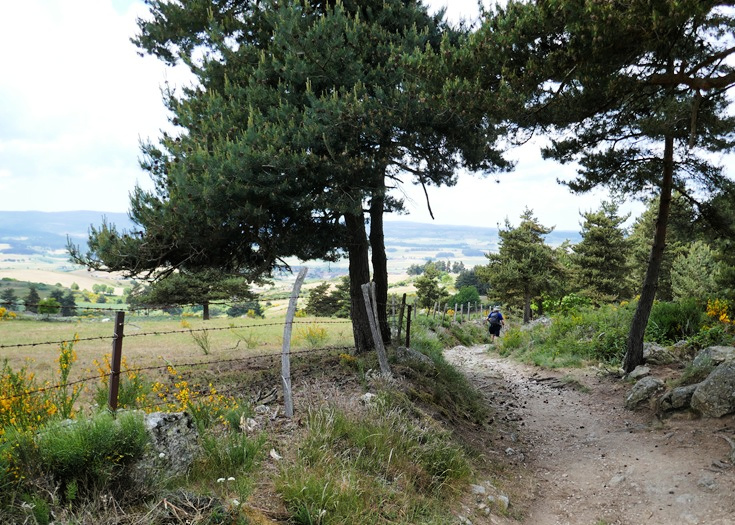
Much gentler terrain on the Chemin de Saint-Jacques approaching Saugues
Where will I find accommodation?
Once you’ve determined how far you’d like to walk each day, where you’ll stop is usually determined by where you’ll find accommodation. All good guidebooks will include accommodation listings for towns and villages along, and close to, the path.
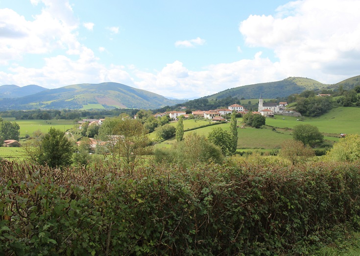
Approaching Ostabat-Asme where you’ll find four gîtes offering a total of 45 beds
Without a guidebook, there are still several ways to find accommodation options.
(1) Check the website of the relevant Office de Tourisme, looking for tabs marked Dormir (sleep) or Hébergement (lodging).
(2) Zoom in on Google maps where hotels, chambre d’hôtes, gîtes and campgrounds are often tagged.
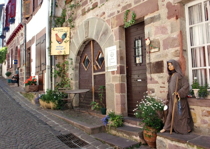
Rue de la Citadelle in Saint-Jean-Pied-de-Port is lined with lodgings for walkers finishing the Chemin de Saint-Jacques or beginning the Camino Frances
How to pull it all together
To get started I—
(1) Open an Excel spreadsheet and my TopoGuide (or other guidebook) and compile a list of every town and village along the way and the distances between them.
(How do I calculate distances when I don’t have a guidebook?)
(2) Mark all towns and villages offering accommodation and highlight any that I particularly want to stop at overnight or spend extra time exploring.
It can be useful to make a note next to each village of how much accommodation is offered, for example 2 chambres d’hôtes, 6 gîtes etc. This will show at a glance the villages with limited accommodation which may need to be booked in advance and the villages with plenty of options where you can safely delay booking until a day or two before.
(3) Check there are no impossibly long sections without accommodation—this is, after all, a holiday and not an endurance test.

The exceptionally pretty Relais de Saint-Jacques in Collonges-la-Rouge
Although it’s likely you have a preference between staying in small hotels, chambres d’hôtes, gîtes or campgrounds, the more flexible you are willing to be, the more options you’ll have when deciding where to stop for the night.
(Accommodation names in France can be confusing. What is a gîte, a chambre d’hôte?)
I am happy to stay in a hotel, chambre d’hôte or gîte (although I’m not fond of bunk beds) but I don’t carry a tent and I avoid camping. If you know that you will only be happy in a hotel with a private bathroom, then your options will be more limited and a longer day may be necessary from time to time. On these occasions, perhaps a rest day soon after will ease any stiff muscles and sore feet.
The magnificent landscapes of the Chemin de Stevenson
For most people a walking pace of four kilometres (2.5 miles) per hour can be comfortably maintained throughout the day. (This is true even if you normally maintain a much faster pace on your daily walk around the neighbourhood.) This relaxed pace allows plenty of time to stop for a drink, admire the scenery and to take lots of photos. If you add in an hour for lunch and other rest stops, then anywhere between 16—25 kilometres (10—15 miles) is a reasonable target for a day’s walk.
Although I have, in the past, started most walks covering 20—25 kilometres (12.5—15 miles) each day, I have come to appreciate the benefits of starting more slowly. Restricting my first week to shorter days of around 15 kilometres (9.5 miles) allows plenty of time to loosen up my leg muscles and ease into a comfortable walking rhythm, to notice any hotspots on my feet and take precautionary measures before blisters form, and to make final adjustments to my backpack before tackling any longer days.
(Learned the hard way – Tips for avoiding blisters on a long-distance walk)
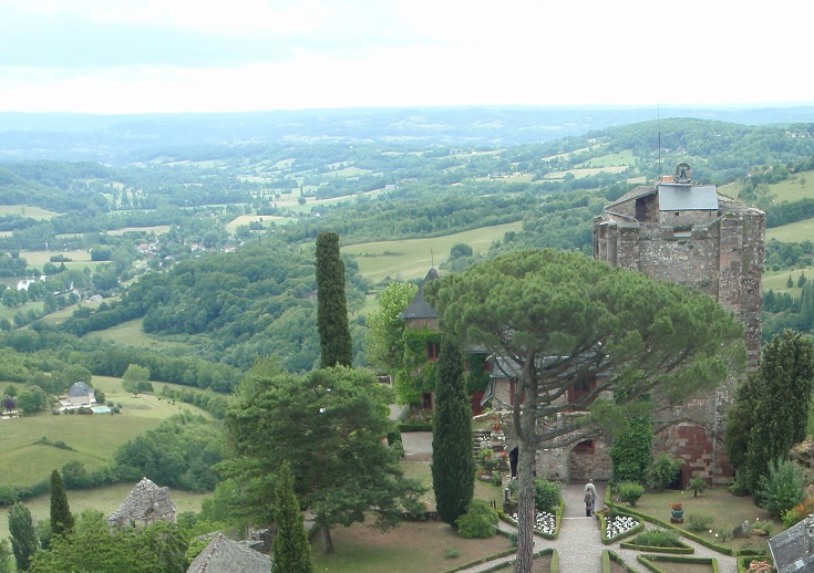
Exploring Château de Turenne and the spectacular view from Tour César
I like to think that walking through France is an excuse to wander from one gourmet meal to the next while exploring every ancient chapel and abandoned château along the way. As a self-confessed ‘researcher’, knowing where I’m likely to encounter an abandoned château, an interesting museum or an exceptional meal and planning my walk around them is all part of the experience.
Once I have an ‘ideal’ itinerary mapped out, the next step, for me, is to book accommodation (in French).
You’ll find lots more practical information here