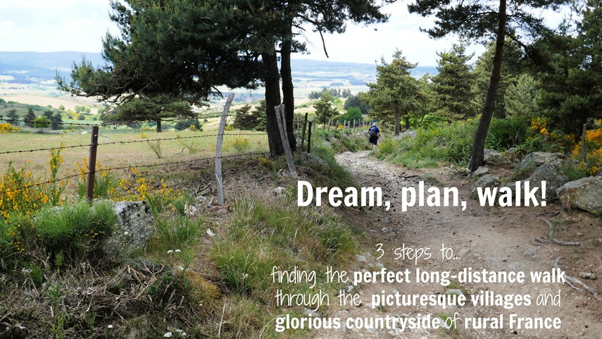
(Published August 2013, last updated February 2026)
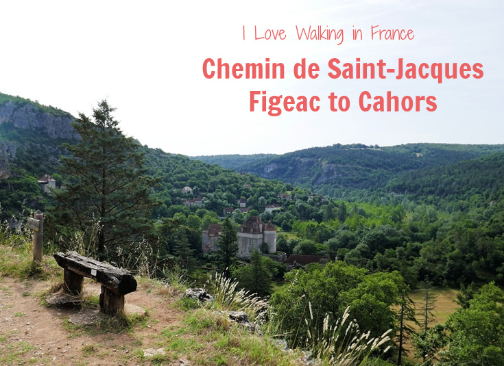
Between Figeac and Cahors, long-distance walkers following the Chemin de Saint-Jacques from le Puy-en-Velay to Saint-Jean-Pied-de-Port have a choice of two quite different routes—the traditional pilgrims’ trail along the GR 65 or the northerly, and somewhat longer, Célé variante.
Each path offers a different experience and caters to different needs.
If your journey along the Chemin de Saint-Jacques and perhaps on to Santiago de Compostelle in Spain is guided by a desire to follow in the footsteps of religious and spiritual ancestors, you may be more drawn to the traditional path taken by early pilgrims along the GR 65.
If, like me, you’re more interested in picturesque villages, painted caves and the crumbling remains of an ancient abbey, then the Célé variante offers some real gems.
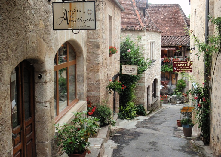
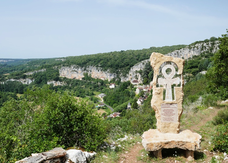
The ‘most beautiful village’ of Saint-Cirq-Lapopie draws me back to the Célé variante time and again
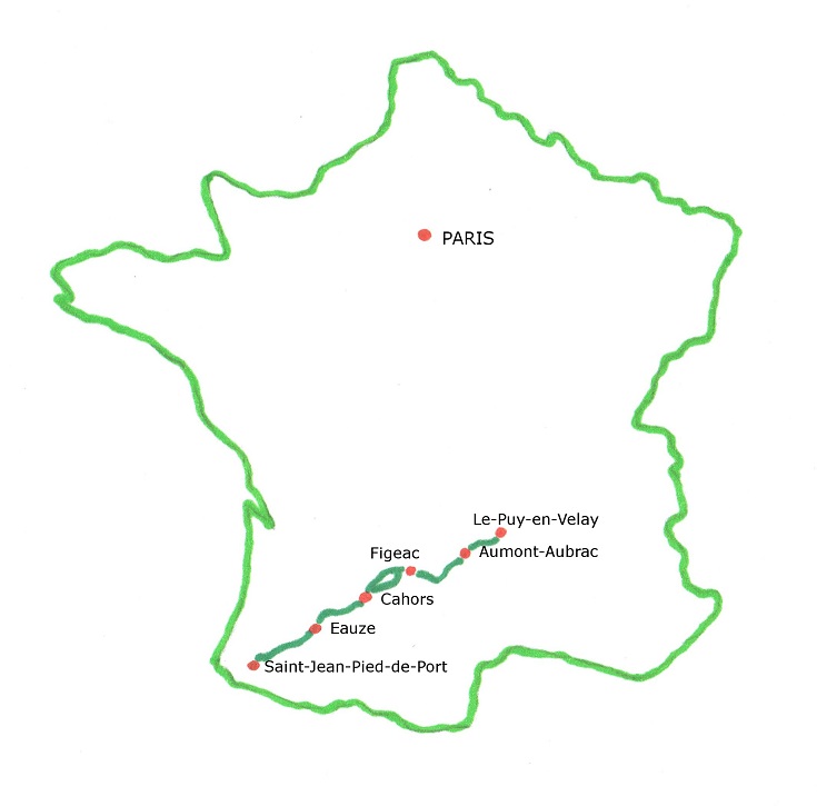
Where is the Chemin de Saint-Jacques in France?
Map of the Chemin de Saint-Jacques from Figeac to Cahors
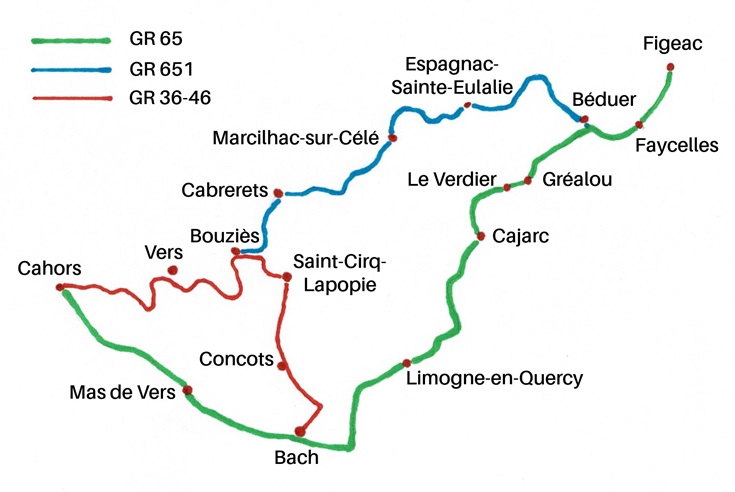
The map of the path shows there are three ways to walk from Figeac to Cahors. You may choose to:
- Follow the traditional route along the GR 65 path. This route takes four or five days and covers 87.3 kilometres (54.6 miles);
- Follow the Célé variante along the route described in most guidebooks—taking the GR 651 to Bouziès, then switching to the GR 36—46 path and heading south to rejoin the GR 65 near Bach. This route takes six days and covers 113.3 kilometres (70.8 miles); or
- Follow the Célé variante to Saint-Cirq-Lapopie, backtrack four kilometres (2.5 miles) to Bouziès, then continue west to Cahors along the GR 36—46. This route takes six day and covers 108.2 kilometres (67.6 miles).
Which path to take is an easy decision for me! Although a little longer than the GR 65, and definitely more strenuous, the Célé variante (I prefer option 3 for the views as you approach Cahors) is always my preferred choice.
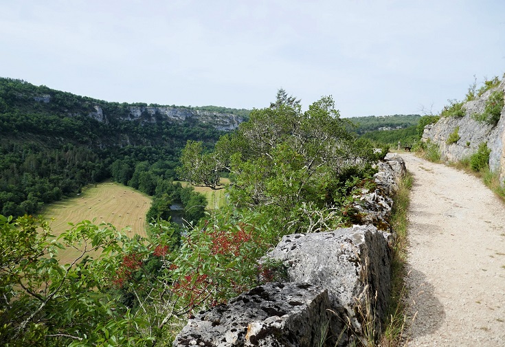
Although most of the towns you’ll visit are located close to the Célé River, the path leaves each village with a steep climb to the top of the ridge before descending again to reach the next town. It’s hard work but the views are magnificent!
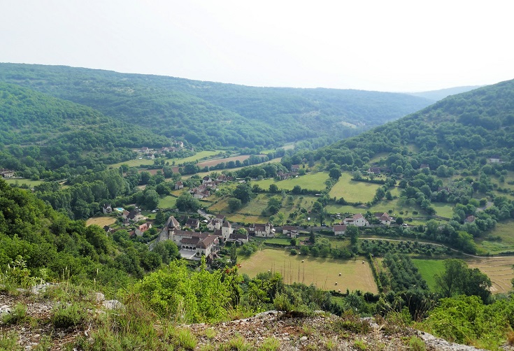
The Célé variante is a strenuous path, climbing the ridge before descending to each of the villages located along the river. The reward is the fabulous views, in this case down to Espagnac-Sainte-Eulalie.
The traditional route along the GR 65 offers a glimpse into life in rural France as the locals experience it, passing through tiny hamlets and bustling market towns. What it lacks in wow factor, it makes up for in convenience with both Cajarc and Limogne-en-Quercy offering a full range of supermarkets, pharmacies and ATMs.
Below, you’ll find accommodation options and itineraries for the Célé variante, followed by accommodation options and itineraries for the traditional GR 65 route.
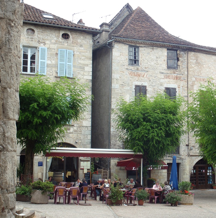
Café in Cajarc draws a crowd after Mass on a Sunday
Accommodation along the Célé variante (continuing west to Cahors from Bouziès)
Accommodation on or very close to the path is available in the following towns.
Distances given from Le Puy-en-Velay:
254.2 km (159.1 mi) Figeac
256.5 km (160.6 mi) Balajou
257.8 km (161.4 mi) La Cassagnole
260.2 km (162.9 mi) La Croix Blanche
260.8 km (163.3 mi) Faycelles
265.5 km (166.2 mi) Béduer
271.5 km (170 mi) Corn
275.3 km (172.3 mi) Sainte-Eulalie
278.5 km (174.3 mi) Espagnac-Sainte-Eulalie
282.5 km (176.8 mi) Brengues
286.5 km (179.3 mi) Saint-Sulpice
293.5 km (183.7 mi) Marcilhac-sur-Célé
302.5 km (189.4 mi) Sauliac-sur-Célé
308.1 km (192.9 mi) Espinières
312.5 km (195.6 mi) Cabrerets
319.5 km (200 mi) Bouziès
323.5 km (202.5 mi) Saint-Cirq-Lapopie
339 km (212.2 mi) Pasturat
341.8 km (214 mi) Béars
342.8 km (214.6 mi) Vers (2km from the path)
345.5 km (216.3 mi) Les Mazuts
349.3 km (218.7 mi) Arcambal (500m from the path)
362.4 km (226.9 mi) Cahors
How to book accommodation in French
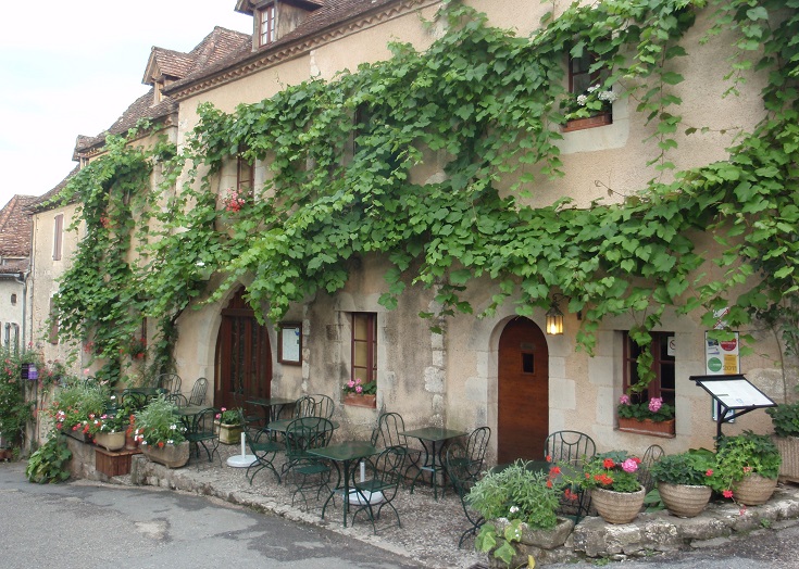
Auberge du Sombral, Saint-Cirq-Lapopie
Six-day itinerary for the Célé variante (108.2 km/67.6 mi)
Day 1 Figeac to Espagnac-Sainte-Eulalie (24.3 km/15.2 mi)
Day 2 Espagnac-Sainte-Eulalie to Marcilhac-sur-Célé (15 km/9.4 mi)
Day 3 Marcilhac-sur-Célé to Cabrerets (19 km/11.9 mi)
Day 4 Cabrerets to Saint-Cirq-Lapopie (11 km/6.9 mi)
Day 5 Saint-Cirq-Lapopie to Vers (19.3 km/12.1 mi)
Day 6 Vers to Cahors (19.6 km/12.3 mi)
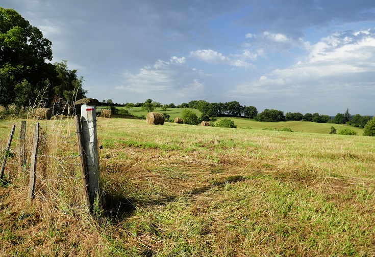
A red and white blaze on a fence post marks the way somewhere between Figeac and Faycelles
Accommodation along the traditional GR 65 route
Accommodation on or very close to the path is available in the following towns.
Distances are given from the starting point of Le Puy-en-Velay.
254.2 km (159.1 mi) Figeac
256.5 km (160.6 mi) Balajou
257.8 km (161.4 mi) La Cassagnole
260.2 km (162.9 mi) La Croix Blanche
260.8 km (163.3 mi) Faycelles
265.8 km (166.4 mi) Pech Rougié
272 km (170.3 mi) Puy Clavel
274 km (171.5 mi) Gréalou
277.1 km (173.5 mi) Le Pigeonnier
280.7 km (175.7 mi) Semberot (300m from the path)
284 km (177.8 mi) Cajarc
288 km (180.3 mi) Gaillac
294 km (184 mi) Saint-Jean-de-Laur
299 km (187.2 mi) Mas de Dalat
300 km (187.8 mi) Mas de Games
303 km (189.7 mi) Limogne-en-Quercy
309.5 km (193.7 mi) Varaire
315.5 km (197.5 mi) Bach
324.5 km (203.1 mi) Mas de Vers
336.1 km (210.4 mi) La Quintade
337 km (211 mi) Marchande
341.5 km (213.8 mi) Cahors
How to book accommodation in French
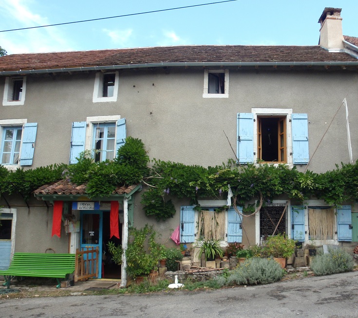
L’Atelier des Volets Bleus, Gréalou, GR65
Five-day itinerary for the GR 65 (87.3 km/54.6 mi)
Day 1 Figeac to Faycelles (6.6 km/4.1 mi)
Day 2 Faycelles to Cajarc (23.2 km/14.5 mi)
Day 3 Cajarc to Limogne-en-Quercy (19 km/11.9 mi)
Day 4 Limogne-en-Quercy to Mas de Vers (21.5 km/13.4 mi)
Day 5 Mas de Vers to Cahors (17 km/10.6 mi)
Four-day itinerary for the GR 65 (87.3 km/54.6 mi)
Day 1 Figeac to Le Pigeonnier (23.3 km/14.6 mi)
Day 2 Le Pigeonnier to Limogne-en-Quercy (25.5 km/15.9 mi)
Day 3 Limogne-en-Quercy to Mas de Vers (21.5 km/13.4 mi)
Day 4 Mas de Vers to Cahors (17 km/10.6 mi)
Look inside the CHEMIN DE SAINT-JACQUES DU-PUY (PDF) guidebook
A delightful stroll through the forest, soon after leaving Mas de Picarel on the Célé variante
The best time of year to walk from Figeac to Cahors
Although most of the small hotels along this section are open throughout the year, many of the chambres d’hôtes and gîtes close from mid to late October, taking a well-earned break before reopening in late March or around Easter.
Snow is rarely a problem on this stage of the walk. Early in the walking season, mornings and evenings can be cool and crisp, and wearing layered clothing which can be added and removed throughout the day works well in all conditions.
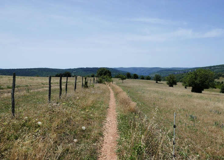
An exposed section of the GR 651 between Espinières and Cabrerets offers no respite from the blistering temperatures
The wildflowers which were so prolific on the earlier stages have largely disappeared as fields in this region are dedicated to agricultural crops and are more likely to feature wheat, haybales, and occasionally corn.
Summer temperatures can be quite high with the occasional 40-degree (Celsius) heatwave. In these conditions, carrying plenty of water and refilling your water bottle whenever you have the chance becomes a high priority. But by September, temperatures begin to fall again and the milder weather is perfect for walking.
The GR 651 path stays high on the ridge without descending into Saint-Sulpice. To take advantage of the snacks and cold drinks available at the campground beside the river requires a detour down to the village.
Do I need to pre-book accommodation?
When it comes to pre-booking accommodation, most walkers fall squarely into one of two camps—those who always do, and those who can’t imagine why locking in your overnight stops in advance would be a good idea. When walking, I definitely fall into the first group, but many walkers set out each morning with little more than a vague plan and successfully find a bed each night.
In May and early June, many French walkers take advantage of a string of public holidays to make their vacation leave go further and head out for a week-long walk. In 2026, these days fall on 1 May (Labour Day), 8 May (Victory in Europe Day), 14 May (Ascension Day) and 25 May (Whit Monday) and accommodation can be tight during these weeks.
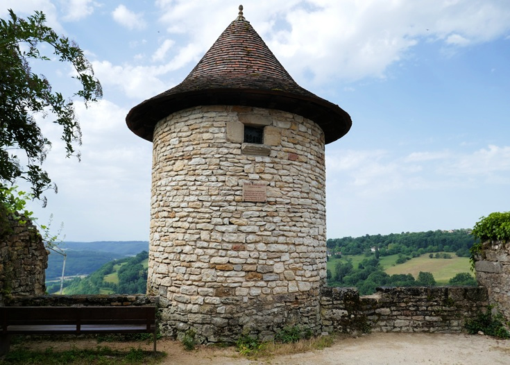
Tour Gaillarde is believed to be one of the watchtowers that guarded Château de Faycelles
Mid-June through until late August is usually a quieter period and there is less demand for accommodation. Then, when school holidays finish in early September, many French grandparents are relieved of baby-sitting duties and once again, the chemin sees an increase in the number of older walkers seeking beds for the night.
On the Célé variante, accommodation options are fewer and the number of walkers is usually higher. The increased demand can place a strain on available beds, and if you decide to follow this path, I recommend booking your accommodation in advance. And if there is a particular village, hotel, chambre d’hôte or gîte that you’d like to stay at, on either route, I always recommend booking a bed as early as possible.
Saint-Cirq-Lapopie in the summer months, looking its prettiest for the many visitors
The more flexible you are with types of accommodation (the occasional more expensive hotel or more basic bunk bed dormitory) and distances walked (perhaps a longer or shorter day than you would prefer), the better your chances of finding a bed. If you have been walking for a week or more, you’ll have a good feel by now for how busy the path is and whether you need to book several days ahead or can wait until the morning before.
If you enjoy participating in the communal dinner each night, booking your room and dinner the day before gives your host time to prepare and is a courtesy that is always appreciated. And if you have any special dietary considerations, a few days’ notice may be the difference between a delightful meal and settling for trail mix.
View down to the valley near Sauliac-sur-Célé on the Célé variante
Luggage transfers
The Chemin de Saint-Jacques du-Puy is blessed with several companies who will transport your luggage on to your next destination. Make sure your bags meet all weight and size requirements, are clearly labelled and are in the foyer by 8am each morning. Your bag will be delivered to your accommodation (according to your booking instructions) later that day.
Be aware that transfer companies generally do not collect and deliver to accommodation that does not provide a secure place to leave luggage. If you book accommodation through a hotel booking website that provides access remotely via a code, you may need to make arrangements to have your bags delivered elsewhere.
Each of these companies has slightly different prices, weight limitations, and start and end of season dates. Check each one for the service that suits you best.
La Malle Postale (Le Puy-en-Velay to Aire-sur-l’Adour)
Transport Lample (Le Puy-en-Velay to Moissac)
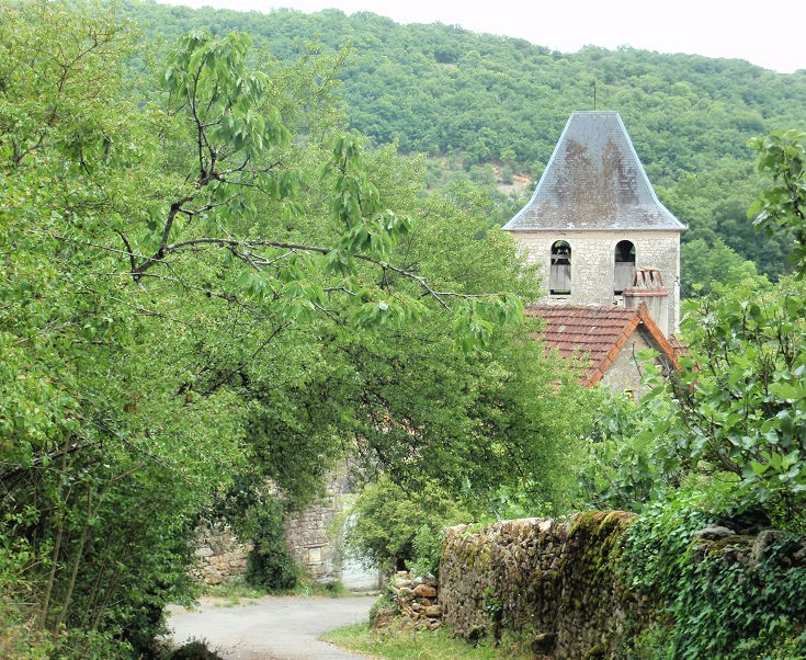
The village of Corn, Célé variante
Transport options to and from Figeac
Train line Aurillac—Figeac—Toulouse connects Figeac to Aurillac and Toulouse (and several other towns) which both have daily train connections to Paris.
Train line Rodez—Figeac—Brive connects Figeac to Decazeville (an earlier town on the GR65 path), to Brive-la-Gaillarde and Rodez for train connections to Paris, and to Rocamadour—a magnificent medieval city which makes a perfect day trip from Figeac.
Lot bus line 876 Figeac—Rocamadour—Padirac connects Figeac with Gramat, Rocamadour and Padirac.
Transport options along the Chemin de Saint-Jacues
Lot bus line 889 Figeac—Cahors connects Figeac with several other villages along the Chemin de Saint-Jacques including Faycelles, Cajarc, Tour-de-Faure (Saint-Cirq-Lapopie), Bouziès, Vers and Cahors.
Lot bus line 883 Limogne-en-Quercy—Cahors runs on weekdays only, connecting Limogne-en-Quercy with Cahors and stopping also at Concots which is located midway along the section of the GR 36—46 that links the GR651 (Célé variante) back to the GR 65.
Transport options to and from Cahors
Train line Brive—Cahors—Toulouse connects Cahors to Brive-la-Gaillarde and Toulouse which both have daily train connections to Paris.
Find many more practical tips on preparation, packing, choosing a guidebook and avoiding blisters.
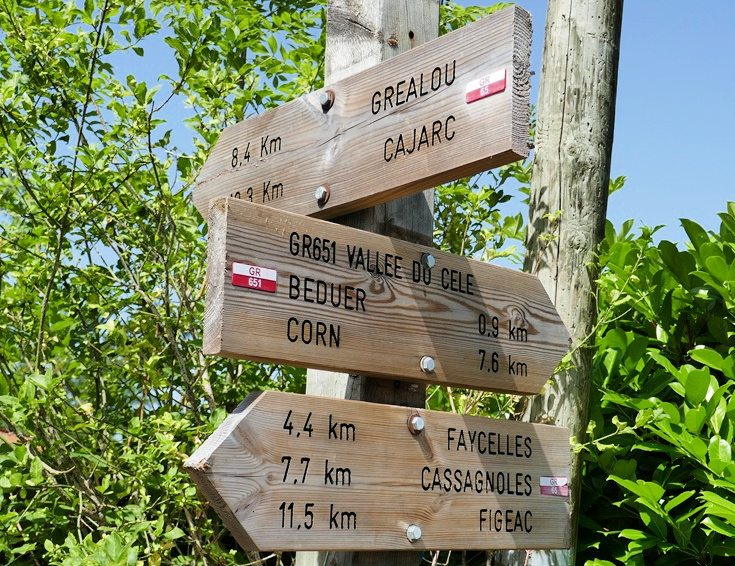
Shortly before Beduer the GR 651, or Célé variante, peels away from the GR 65
Look inside the CHEMIN DE SAINT-JACQUES DU-PUY (PDF) guidebook
TRADITIONAL ROUTE OR CÉLÉ VARIANTE?
Before diving into a comparison of the two paths, let’s look at the towns common to both—Figeac, Faycelles and Cahors.
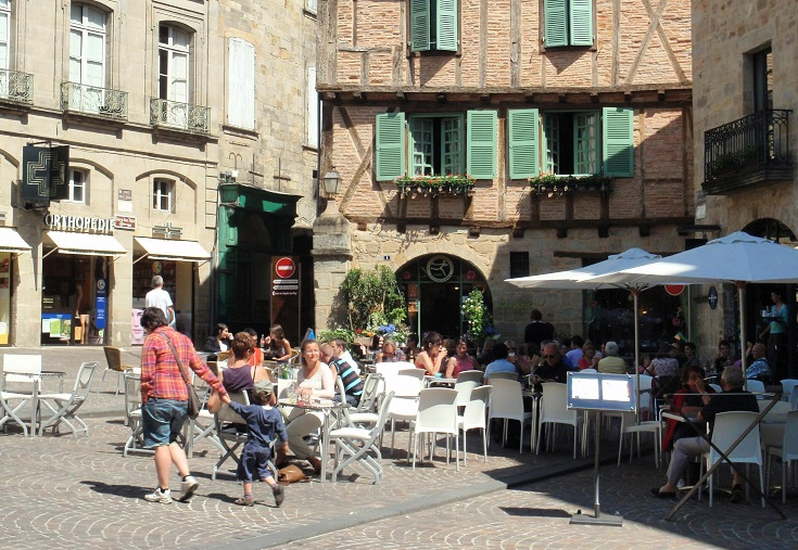
Place Champollion in Figeac
Figeac
Classified a ville d’art et d’histoire, Figeac is a beautiful town of almost 10,000 people spanning the River Lot. Filled with medieval stone and timbered houses, the backstreets and crooked alleys are a delight to wander through.
Figeac was the birthplace of Jean-François Champollion, the nineteenth-century French scholar who spent more than a decade deciphering the hieroglyphics of the Rosetta Stone. His home is now a museum where you can explore the history of writing.
If you have been walking since Le Puy-en-Velay and have not yet stopped for a rest day, Figeac is the perfect place to take a break. The town boasts a full range of services—dozens of cafés, patisseries, chocolateries as well as the ever-useful banks, doctors, dentists and ATMs!
Take a closer look around Figeac and find a comprehensive list of accommodation and transport options.
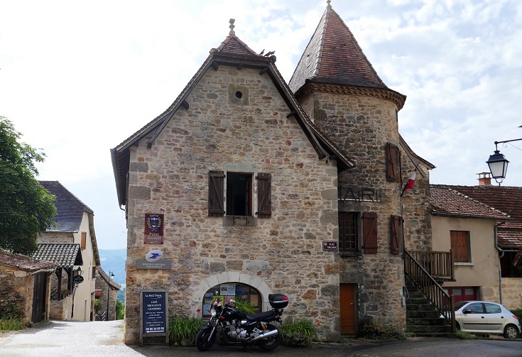
The gîte and mairie in Faycelles are located in a medieval building
Faycelles
If you are not ready for a full rest day in Figeac, but would like to spend some time exploring, an overnight stop in the next village of Faycelles provides a good short-walking day option.
Located 6.6 kilometres (4.1 miles) from Figeac, this usually sleepy village boasts impressive historic credentials. Archaeological digs have uncovered remnants of village life dating from the fourth century, and it was in Faycelles (or perhaps the nearby village of La Cassagnole) that Charlemagne’s twin sons were born in the eighth century.
A map of Faycelles, available from the Tourist Office in Figeac, will guide you on an hour-long walk around the village, past the church, the towers which are all that remain of the château walls, some ancient water fountains and other historic sites.
The GR 36 path (Célé variante) approaches Cahors, offering magnificent views of the town from Mont-Saint-Cyr
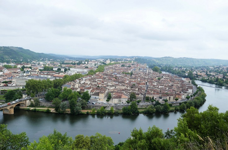
Cahors
Cahors has occupied its position on a loop of the River Lot since Roman settlers arrived in the first century BC. Today, Boulevard Gambetta divides the town neatly down the middle—modern (nineteenth century) civic buildings to the west, and medieval splendour to the east.
Allow some time to explore the town, including the Cathedral dedicated to Saint-Etienne with its tranquil sixteenth-century cloister and the famous Pont-Valentré built, so the legend tells us, with the help of the devil.
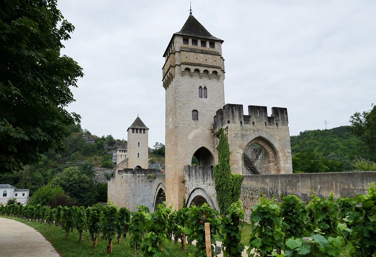
Pont Valentré
Cahors is famous for its red wine, made primarily from Malbec grapes and supplemented with Merlot and Tannat. Production of the wine is governed by the AOC (Appellation d’Origine Controlée) which sets strict guidelines on care of the vines, soil and harvesting times and methods. Wines produced under these regulations depend greatly on the mercy of the sunshine and local rainfall and result in vintages which vary from year to year. But they all contain a large dose of love (and none of the chemicals which usually give me a headache!). If you have an afternoon to spare, ask at the Tourist Office about winery tours.
Take a closer look around Cahors, discover the story behind the devil on Pont-Valentré and find a comprehensive list of accommodation and transport options.
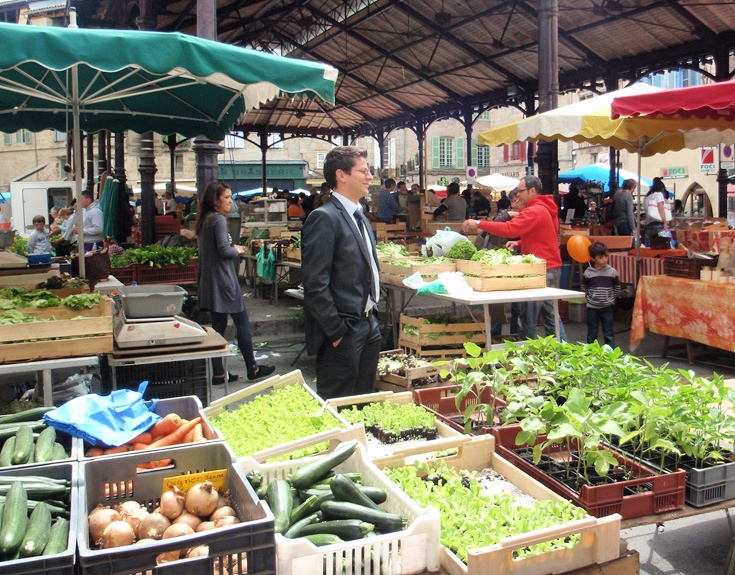
Saturday morning market in Figeac
Fresh food markets
No matter which route you follow, you’ll find fresh food markets along the way. Some operate only during the summer months, so make the most of the plentiful seasonal produce and pack a picnic lunch for the day’s walk.
Figeac—Saturday morning
Cajarc—Saturday afternoon
Limogne-en-Quercy—Sunday morning
Varaire—Friday evening
Brengues—Thursday evening in July and August
Marcilhac-sur-Célé—Tuesday evening in July and August
Cabarets—Friday morning from May to October
Saint-Cirq-Lapopie—Wednesday evening in July and August
Vers—Thursday morning from May to September
Arcambal—Sunday morning
Cahors—Wednesday and Saturday mornings
HIGHLIGHTS OF THE CÉLÉ VARIANTE
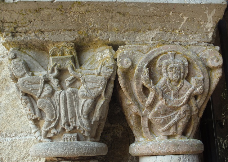
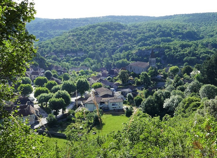
Marcilhac-sur-Célé
In the tenth century, Benedictine monks built an abbey—dedicated to Saint-Pierre—on the banks of the River Célé. All that remains intact of that abbey is the Chapter House where the monks met, but you’ll see glimpses of the original splendour in the ancient columns and the tympanum above the entrance.
You’ll reach Marcilhac-sur-Célé, the village that grew around the abbey, after a shortish (15 km/9.4 mi) walk from Espagnac-Sainte-Eulalie, giving you ample time to immerse yourself in the medieval ruins.
Take a closer look around Marcilhac-sur-Célé and find a comprehensive list of accommodation and transport options.
The village of Cabrerets, viewed from Pech Merle
Pech Merle
Located just outside the village of Cabrerets is Pech Merle—widely considered to include the most beautifully preserved historic rock paintings and natural rock formations in France. To gain entrance, take the one-hour-long guided tour (most tours are conducted in French but free booklets are available in several other languages).
Visitor numbers are limited to 700 per day and advance bookings are recommended. If you are following my suggested itinerary, you’ll have plenty of time for a morning tour before heading off towards Saint-Cirq-Lapopie. (If you are taking each day as it comes, a tour booking the day before should suffice.)
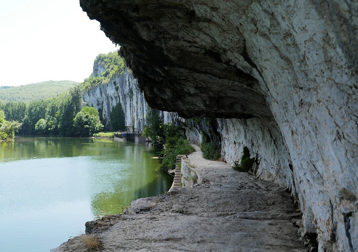
Chemin de Halage, between Bouziès and Saint-Cirq-Lapopie
Chemin de Halage
Between Bouziès and Saint-Cirq-Lapopie, the path follows the Lot River which, in the Middle Ages, was the primary route for transportation for goods throughout the area. Flat bottomed barges carried regional produce west towards Bordeaux on the Atlantic Coast and returned with goods which were not available locally. On the return journey, teams of men or horses were needed to haul the barges against the upstream currents.
In one section, more than one kilometre in length, steep cliffs rose abruptly from the river’s edge and a towpath was carved from the rock, allowing the men and horses to continue their walk.
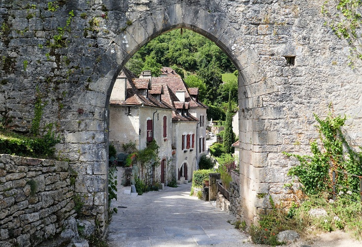
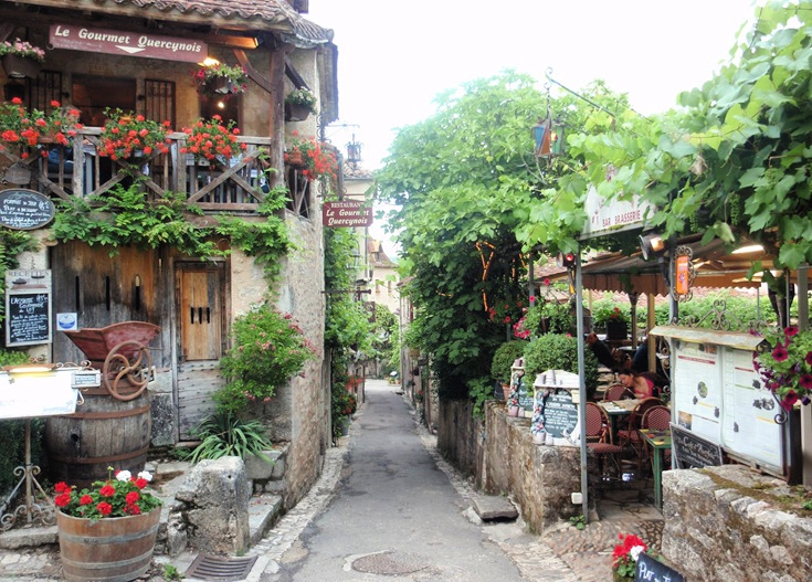
The ‘most beautiful village’ of Saint-Cirq-Lapopie
Saint-Cirq-Lapopie
Saint-Cirq-Lapopie is a jewel among France’s most beautiful villages (one of eleven that you’ll visit along the Chemin de Saint-Jacques du-Puy) and offers a bewildering array of cafés, gift shops and impossibly pretty houses. I think it requires a full-day visit to do it justice (preferably on a Wednesday when the summer market is in full swing), otherwise you’ll be planning a return visit as you walk out of town. (If your schedule doesn’t allow for a full day off, an afternoon bus will take you from nearby Tour-de-Faure on to Vers the following day.)
This stunning village is the main reason I recommend taking the Célé variante rather than the traditional pilgrims’ trail but take a sneak peek from the link below and decide for yourself.
Take a closer look around Saint-Cirq-Lapopie and find a comprehensive list of accommodation and transport options.
HIGHLIGHTS OF THE GR 65
Back street in Cajarc, GR 65
Cajarc
If you choose to follow the traditional GR 65 path, I recommend allowing a couple of hours to explore Cajarc. A map of the town available from the Tourist Office, will guide you through the quaint side streets, past a twelfth-century home and its more modern thirteenth- and fourteenth-century neighbours.
The seventeenth-century church, dedicated to Saint-Etienne, stands proudly on the square in the centre of town. If you look closely, you’ll notice much older stones at the base of the bell tower—all that remains of the original thirteenth-century church which was almost completely destroyed during the Wars of Religion.
Take a closer look around Cajarc and find a comprehensive list of accommodation and transport options.
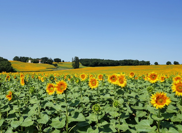
Continue on beyond Cahors to enjoy the glorious fields of summer sunflowers
From Cahors, continue on to other sections of the Chemin de Saint-Jacques du-Puy
Stage 1: Le-Puy-en-Velay to Aumont-Aubrac
Stage 2: Aumont-Aubrac to Figeac
Stage 3: Figeac to Cahors
Stage 4: Cahors to Eauze
Stage 5: Eauze to Saint-Jean-Pied-de-Port
Ready to plan your walk along the Chemin de Saint-Jacques du-Puy?
Purchase the Chemin de Saint-Jacques (PDF) guidebooks
Purchase five guidebooks covering Le Puy-en-Velay to Saint-Jean-Pied-de-Port
Look inside the CHEMIN DE SAINT-JACQUES DU-PUY (PDF) guidebook