(Published May 2014, last updated March 2026)
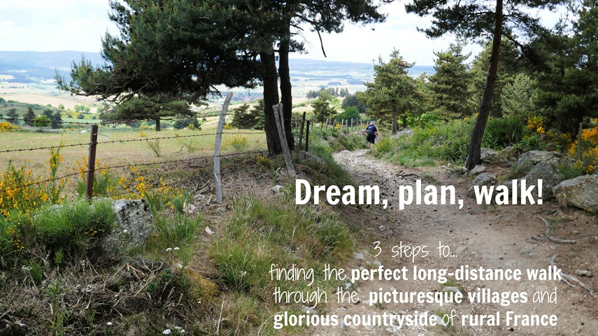
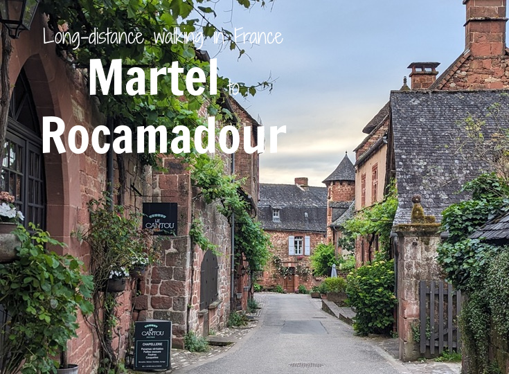
The nine-day walk from Martel to Rocamadour weaves through 127 kilometres (80 miles) of glorious French countryside. Located in the Lot and Corrèze Valleys (adjoining the better-known Dordogne region), this walk visits fairy-tale castles, underground caves and passes through nine of France’s most beautiful villages.
It’s a walk best taken slowly; an experience to be savoured and enjoyed. Each day will bring new delights, and your biggest challenge will be deciding whether to linger where you are or move on to discover the next village.
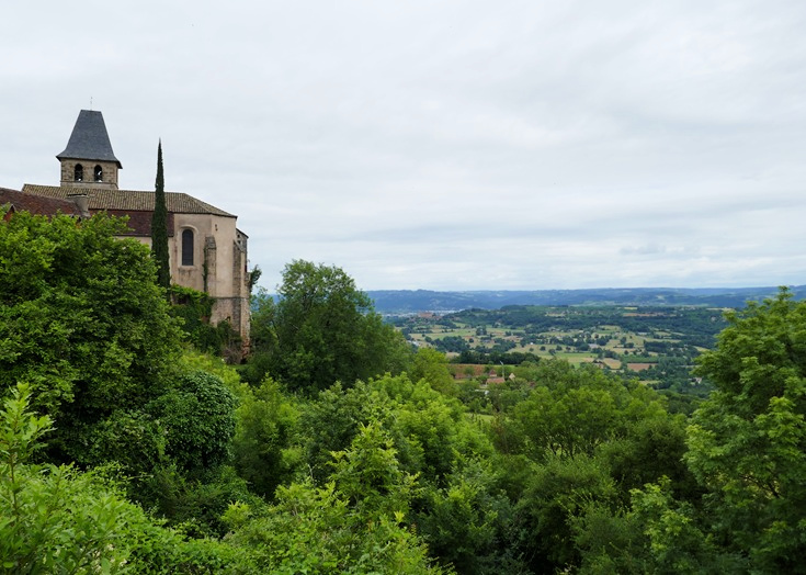
View from the lookout beside the château in Loubressac
My suggested itinerary leaves plenty of time to lean against the stone walls of an ancient chapel and ponder the hands that built them a thousand years earlier; to look out through the observation slits in a medieval tower and imagine invading armies charging up the hill…
LOOK INSIDE THE MARTEL TO ROCAMADOUR (PDF)GUIDEBOOK
Where is it in France?
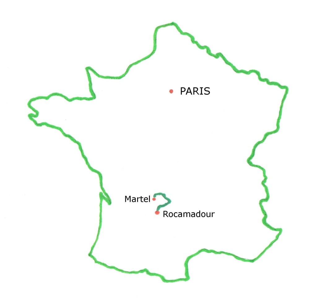
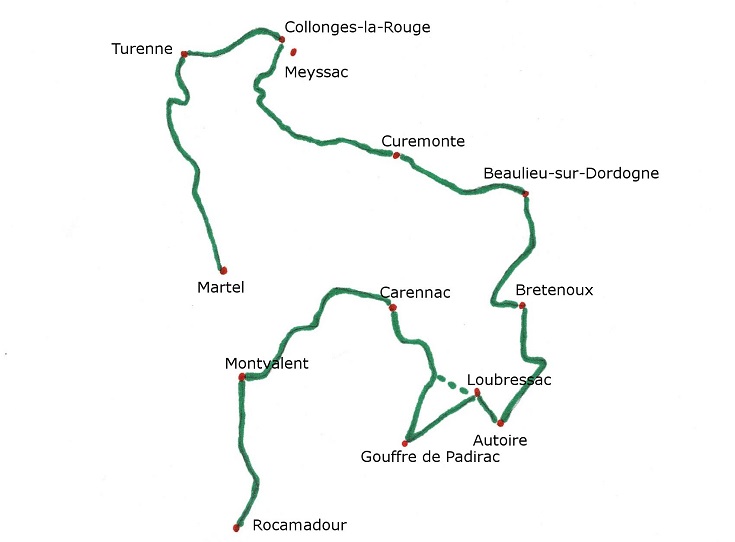
Map of the walking path from Martel to Rocamadour
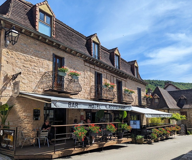
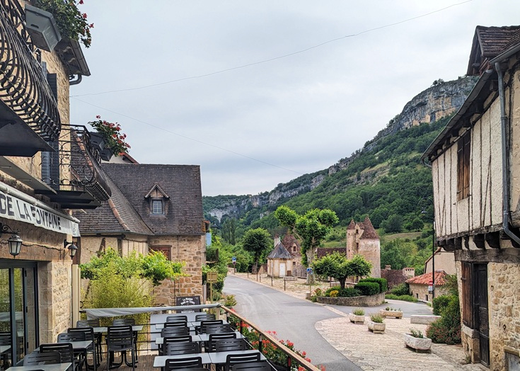
Auberge de la Fontaine, Autoire
Accommodation from Martel to Rocamadour
Villages along the long-distance walking path from Martel to Rocamadour offer accommodation at intervals to suit most walkers. The distances given are based on following the GR 46, GR 480 and GR 652 walking paths (and a minor road between Beaulieu-sur-Dordogne and Bretenoux).
0.0 km (0.0 mi) Martel
18.2 km (11.4 mi) Turenne
26.5 km (16.6 mi) Collonges-la-Rouge
43.3 km (27.1 mi) Curemonte
56.1 km (35.1 mi) Beaulieu-sur-Dordogne
69.3 km (43.3 mi) Bretenoux
79.7 km (49.8 mi) Autoire
85.2 km (53.3 mi) Loubressac
100.2 km (62.6 mi) Carennac
117 km (73 mi) Montvalent
126.4 km (79 mi) l’Hôpitalet
127.4 km (79.6 mi) Rocamadour
How to book accommodation in French
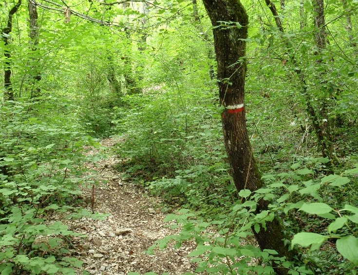
A red and white blaze marks the GR 652 path near Autoire
GR paths and IGN maps
The walk from Martel to Rocamadour follows a number of connecting Grand Randonnée paths—switching from the GR 46 to the GR 480 and finally to the GR 652. It is important to have easy access to a map and to have a clear idea of where you are, which path you are following, and in which direction you are headed.
The Institut Géographique National (IGN) Series Bleu (1:25,000 scale) maps provide a lot of detail, including topographical contours, villages, rivers and the GR path. They do not extend to street level but provide more than enough detail to guide you safely each day. Having one will allow you to assess possible shortcuts along a road, give you a feel for how far away the next village is and perhaps find a detour around the occasional hill.
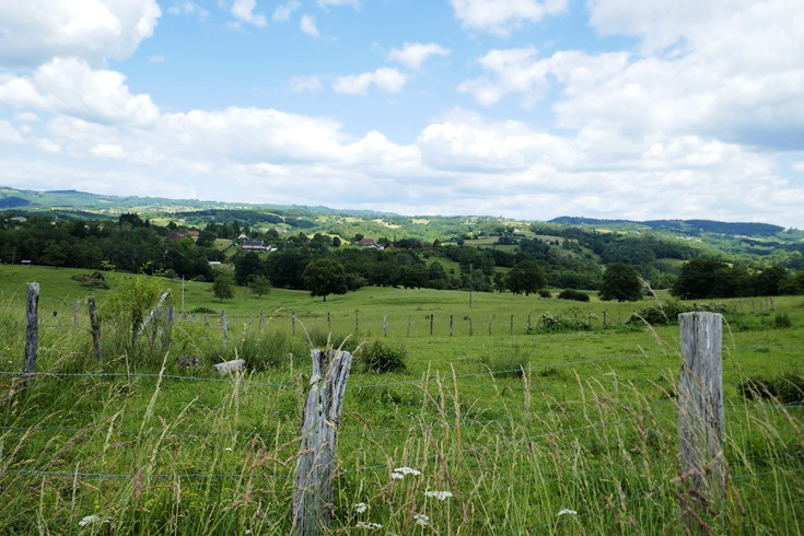
A stroll through the countryside between Collonges-la-Rouge and Curemonte
It’s worth keeping in mind that maps carried in the local store, especially for less well-trodden walks such as this one, are often well out of date and do not reflect recent changes to the route. This may not be noticed until you are on the trail and nothing is making sense.
A more reliable approach is to view the maps, and track your location using the GPS tracker on your mobile phone, with the free Cartes IGN app (available for both Android and Apple phones).
The GR 652 path climbs a steep ridge shortly after leaving Autoire
As you plan your walk and finalise your stages, I recommend checking the IGN map (via the app or the GéoPortail website) for sections where the route might be shortened or a steep climb or descent might be avoided. In the guidebook, I offer several suggestions for sections where alternative routes provide an easier day’s walk.
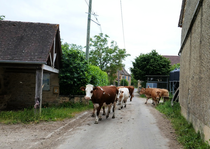
The alternative route from Autoire to Loubressac follows a quiet country road where the most traffic you’ll encounter has four legs instead of wheels
Suggested itinerary for walking from Martel to Rocamadour
In June 2024 I returned to Martel and headed once more for Rocamadour, but instead of following the GR paths exclusively, I studied the local topographic maps looking for other local paths or quiet country roads which would link all the ‘most beautiful villages’ that I wished to visit.
And, of course, I wanted to time my walk to coincide with as many local markets as possible and to ride the steam train from Martel along the cliffs of Mirandol.
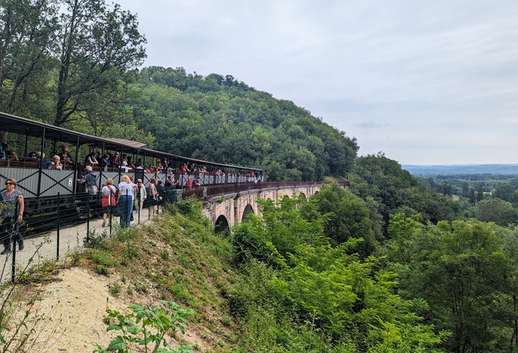
The steam train which travels along the Cliffs of Mirandol makes several stops allowing passengers to disembark
With a focus on not rushing through any of the nine ‘most beautiful villages’, I added an extra day to the itinerary with an overnight stop in the village of Autoire between Bretenoux and Loubressac. This allows for a more relaxed day with plenty of time to enjoy the guided tour of the apartments at Château de Castelnau-Bretenoux before walking on to Autoire. If your time is limited, by all means, continue on to Loubressac on day 6.
The last section, from Carennac, requires a walk of 26.2 kilometres (16.4 miles) to l’Hôpitalet or 27.2 kilometres (17 miles) if you continue on to Rocamadour. This was further than we wished to walk and, to reduce the distance, we took a taxi to Montvalent and continued our walk from there. (Accommodation options close to Montvalent have recently been added, allowing this section to be split in two days of 16.7 kilometres (10.4 miles) and 10.5 kilometres (6.6 miles).)
If you wish to return to Martel at the end of your walk, follow the GR 652 back to Montvalent, then continue north along the GR 46 to Martel.
View from Tour César, Turenne
Day 1 Martel to Turenne (18.2 km/11.4 mi if following the GR 46). Arrive in time to explore the château.
Day 2 Turenne to Collonges-la-Rouge (8.3 km/5.2 mi if following the GR 480). Arrive in time for lunch and spend the afternoon relaxing and exploring the village.
Day 3 Collonges-la-Rouge to Curemonte (16.8 km/10.5 mi if following the GR 480).
Day 4 Curemonte to Beaulieu-sur-Dordogne (12.8 km/8 mi if following the GR 480).
Day 5 Beaulieu-sur-Dordogne to Bretenoux (13.2 km/8.3 mi if following the D41 and D803 departmental roads).
Day 6 Bretenoux to Autoire (10.4 km/6.5 mi if following the GR 652). Visit Bretenoux markets (Tuesday or Saturday mornings only) and Château de Castelnau-Bretenoux as you pass by in the morning.
Day 7 Autoire to Loubressac (5.5 km/3.4 mi if following the GR 652). (This is a steep and challenging section of the GR 652. In the guidebook, I recommend an alternative route to reach Loubressac).
Day 8 Loubressac to Carennac (15 km/9.4 mi). Take time for a tour of the Gouffre de Padirac and arrive in Carennac in the afternoon, in time to visit the church and cloister.
Day 9 Carennac to Rocamadour (27.2 km/17 mi following the GR 652).
Day 10 (optional to complete the loop) Rocamadour to Martel (20 km/112.5 mi).
If you prefer to set your own agenda, I share the steps I take to plan my itinerary on any long-distance walk.
LOOK INSIDE THE MARTEL TO ROCAMADOUR (PDF) GUIDEBOOK
Place de l’Église, Carennac
The best time of year to walk from Martel to Rocamadour
You’ll find the villages at their prettiest during the summer months—late June, July and August—when the newly planted garden beds are a riot of colour and the shutters are freshly painted. This is a beautiful, and deservedly popular, part of France, and the long sunny days attract many visitors.
At other times of the year, many attractions will close for lunch and for one full day during the week, but during July and August, you’ll enjoy more freedom when planning your day.
(When I returned in 2024, walking for the first two weeks of June, all the villages looked fabulous—except for Curemonte where the gardens beds were freshly turned but the flowers had yet to be added.)
Between October and April, there are few tourists visiting the area and many of the gift shops and cafés, and some of the accommodations, in the smaller villages will close for a long break. Although the medieval stone buildings look fabulous at any time of year, the winter months can feel quiet and lonely.
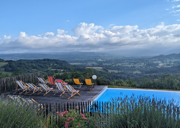
A fitting reward for a day’s walk on the terrace of Relais de Castelnau in Loubressac
Do I need to pre-book accommodation?
Some villages, such as Turenne and Autoire, have very limited accommodation listings and beds can be scarce during the summer holidays. Once you have decided which villages you plan to stop in overnight, I recommend booking your accommodation in advance.
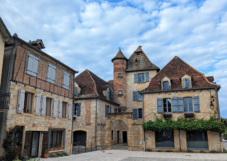
Place des Consuls, Bretenoux
Luggage transfers
When I planned my return in June 2024, I searched high and low for a company that would transport my luggage with no luck. Since then, two friends have successfully used the parcel delivery service available from Taxi Martinez to move their luggage. This can be expensive, as taxis generally are, but if you are able to share the cost with a few walking buddies, gives you the convenience and peace of mind of organising everything before you start walking.
(Note: there are several companies that organise self-guided walks in the Dordogne region but none call in to Martel, Turenne or Collonges-la-Rouge!)
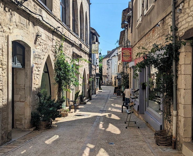
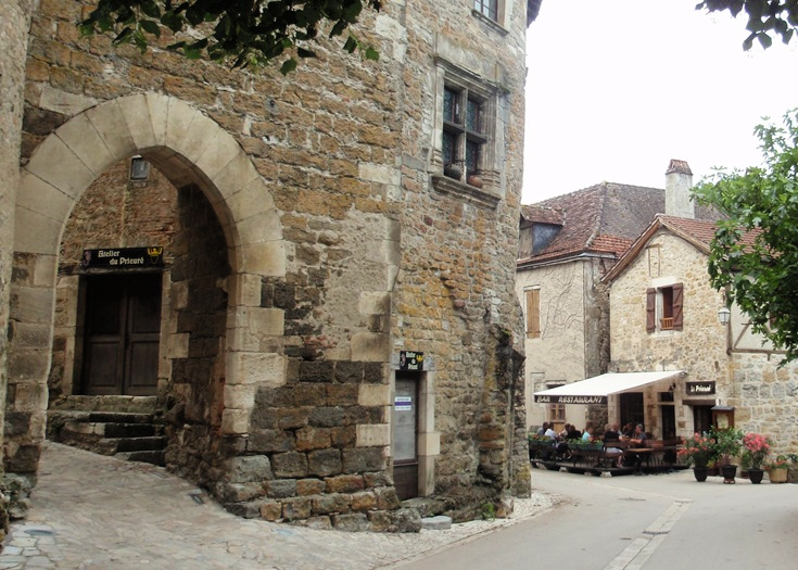
Backstreet in Martel
Transport options to and from Martel
On school days, Martel is most easily reached on Lot bus line 888 from Saint-Denis-près-Martel or Souillac which both have good rail connections to other parts of France.
Saint-Denis-près-Martel is located on train line 67 from Aurillac to Brive la Gaillarde which also stops at la Gare de Turenne and Bretenoux-Biars (sometimes referred to as Biars-sur-Céré), and the Rodez—Figeac—Brive train line which also stops at la Gare de Turenne and Rocamadour-Padirac. (Note: la Gare de Turenne is located three kilometres from the village of Turenne, and Rocamadour-Padirac train station is located four kilometres from the village.)
Souillac is located on the Brive—Cahors—Toulouse train line.
Transport options to and from Rocamadour
Rocamadour is located four kilometres from Rocamadour-Padirac train station. From there, the Rodez—Figeac—Brive train line will take you to Figeac (on the Chemin de Saint-Jacques du-Puy), Gramat, Rodez or Brive-la-Gaillarde.
In July and August, two summer bus lines run daily services to other villages along the walk, and beyond.
Lot bus line 876 operates on weekends and public holidays from June to September, with daily services in July and August, connecting Rocamadour (village and train station) to L’Hospitalet, Figeac, Gramat and Padirac (village and Gouffre).
Lot bus line 877 operates on weekends and public holidays from June to September, with daily services in July and August, connecting Rocamadour (village and train station) to L’Hospitalet, Biars-sur-Céré, Bretenoux, Château de Castelnau, Padirac (village and Gouffre) and Souillac.
HIGHLIGHTS OF THE WALK FROM MARTEL TO ROCAMADOUR
The fairytale turrets of Hôtel de Friac in Collonges-la-Rouge
Visit nine of the most beautiful villages in France
There are more than 30,000 small villages in France but only 184 of them can claim to be among the ‘most beautiful’. (To qualify, a village must enjoy a rural setting, have a population of less than 2,000 and at least two historical monuments which the community commits to protecting and preserving.)
This corner of France has more than its fair share of most beautiful villages and on the walk from Martel to Rocamadour, you’ll visit:
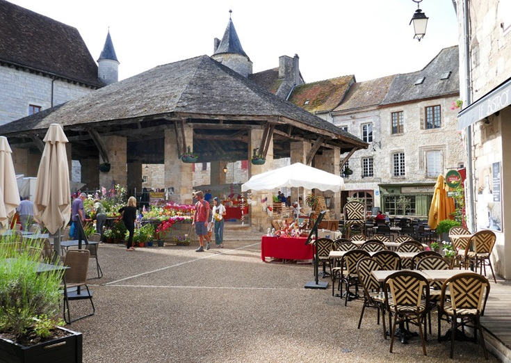
Place de la Halle, Martel
Martel
Founded in the eleventh century, Martel was once the capital and commercial hub of the Turenne region. All that remains now of the walls that once protected the town are seven towers—earning Martel the nickname la ville aux sept tours.
Take a look around Martel and find a comprehensive list of accommodation and transport options.
View from Tour César, Turenne
Turenne
The village of Turenne was once dominated by a château which was home to the ruling families of the region between the tenth and eighteenth centuries. A charming maze of narrow lanes leads uphill to the Guards Rooms, which now contains a small museum, and the twelfth century Tour César which offers commanding views over the countryside.
Take a look around Turenne and find a comprehensive list of accommodation and transport options.
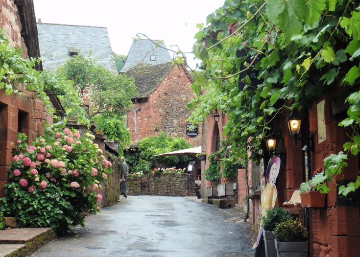
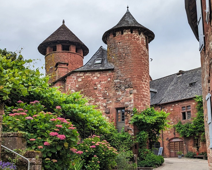
The charming main street of Collonges-la-Rouge
Collonges-la-Rouge
Originally founded by monks in the eighth century around the abbey church of Saint-Pierre, Collonges-la-Rouge is, I think, the highlight of this walk. With its distinctive red-brick cottages and fairy-tale turrets, this gorgeous village was the very first ‘most beautiful village in France’, an association formed in 1981 by then mayor Charles Ceyrac who dreamed of bringing visitors, and economic prosperity, back to the small, picturesque villages scattered throughout France.
Take a look around Collonges-la-Rouge, find a comprehensive list of accommodation and transport options and discover more of the history of the most beautiful villages in France.
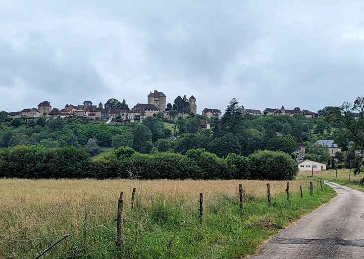
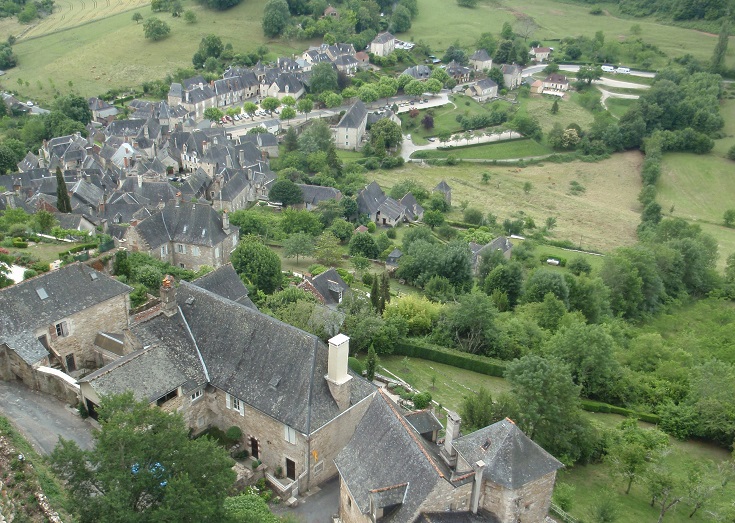
The hilltop village of Curemonte
Curemonte
During the Hundred Years War in the middle of the fifteenth century, many villages in France were destroyed, including la Combe, where life in this part of the world was centred. Today, only the twelfth-century church in nearby Branceilles remains. The villagers moved a short distance to the site of present-day Curemonte, building homes around three châteaux constructed during the fourteenth and fifteenth centuries.
Take a look around Curemonte and find a comprehensive list of accommodation and transport options.
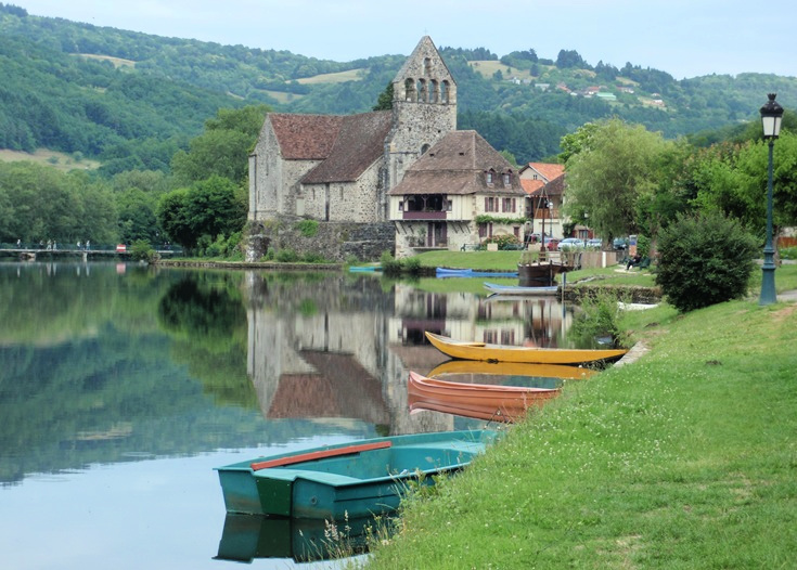
Boats reflecting in the river at Beaulieu-sur-Dordogne
Beaulieu-sur-Dordogne
After the last few days of passing through small villages where pharmacies and supermarkets have been hard to find, Beaulieu-sur-Dordogne offers a welcome opportunity to stock up on bandaids and trail mix and to raid the ATM. The narrow streets wind through a sprawling town centre which surrounds the Benedictine abbey church dedicated to Saint-Pierre and leads down to banks of the river where the Chapelle des Pénitents is reflected in the waters.
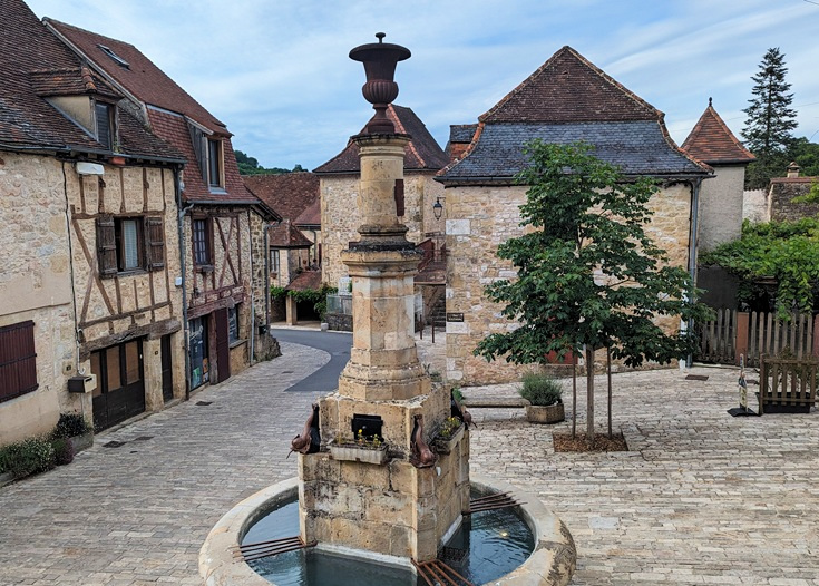
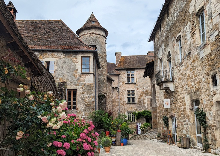
Place de la Fontaine, Autoire
Autoire
First settled in the ninth century, the village of Autoire, nestled in a valley between two high ridges, was devastated during the Hundred Years War with the English. Not a lot has changed since the village was rebuilt five hundred years ago—the elegant stone-and-timber cottages look much the same today as they did then.
Take a look around Autoire and find a comprehensive list of accommodation and transport options.
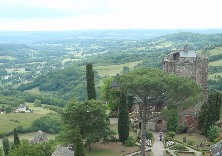
Place de l’Église, Loubressac
Loubressac
Allow an hour or two to explore the narrow streets lined with medieval houses covered in lush vines and surrounded by flower-filled gardens. From the lookout beside the château, relax and enjoy the spectacular views over the surrounding countryside.
Take a look around Loubressac and find a comprehensive list of accommodation and transport options.
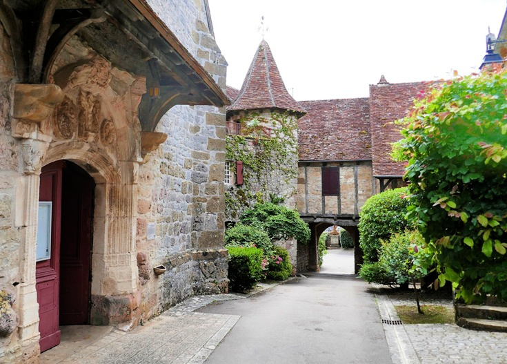
An opening in the château wall leads to Église Saint-Pierre in Carennac
Carennac
Founded in the eleventh century by Cluny monks who built a monastery here in a small clearing by the river, Carennac soon grew to include a château whose high walls protected the occupants. Tucked away next door, behind an arched gate in the wall is the abbey church dedicated to Saint-Pierre with its magnificent entrance and ornately carved tympanum which dates from the twelfth century.
Take a look around Carennac and find a comprehensive list of accommodation and transport options.
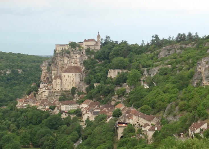
The view of Rocamadour from l’Hôpital
Rocamadour
Nine days of walking from Martel brings you to Rocamadour—an ancient village clinging precariously to the side of cliff, and the second most important religious site (after Mont-Saint-Michel) in France.
It is said that Zaccheus (also known as Armadour and a servant of Mary, mother of Jesus) came to live here in the caves as a hermit, bringing with him a black, wooden statue of the Madonna. The statue is displayed in the Chapelle de Notre-Dame and many famous figures—including King Henri II of England, accompanied by Sir Thomas Beckett—have come to pay their respects over the last nine hundred years.
Take a look around Rocamadour and find a comprehensive list of accommodation and transport options.
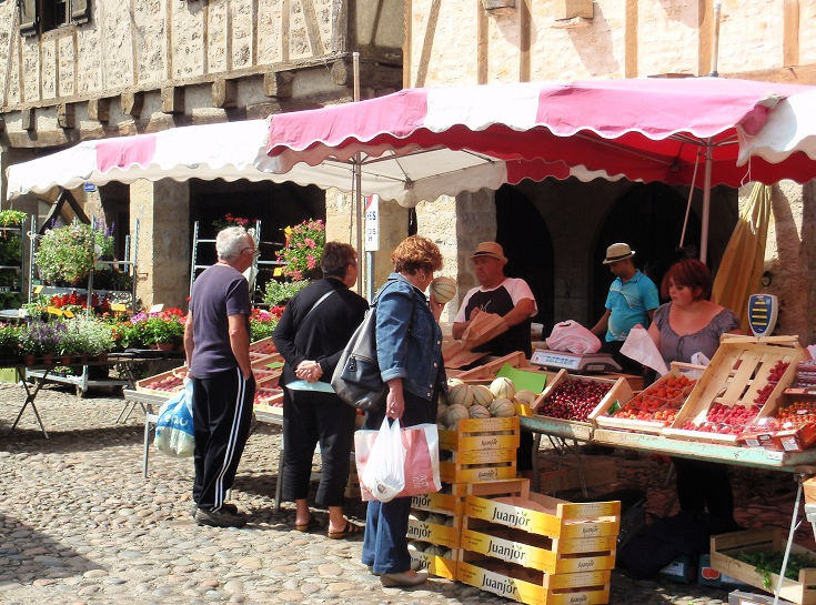
Customers inspect trays of fresh fruit at the Saturday morning market in Bretenoux
Stock up on trail mix at the local markets
In addition to the visual feast that awaits you in these lovely places, you’ll discover fresh food markets at several villages where you can find regional delicacies to bolster your picnic lunches. Time your walk to visit at least one!
Martel—Wednesday and Saturday morning
Curemonte—Wednesday evening in July and August
Beaulieu-sur-Dordogne—Wednesday morning all year, the first and third Friday of each month, and Monday evening in July and August.
Bretenoux—Tuesday and Saturday morning
Carennac—(a very small market) on Tuesday evening in summer
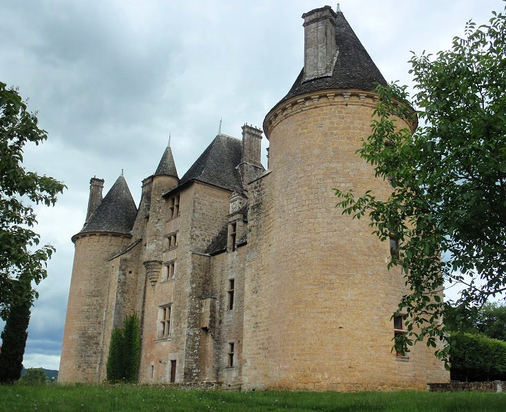
Château de Montal
Explore Château de Montal and Château de Castelnau-Bretenoux
Instead of walking alongside the road from Beaulieu-sur-Dordogne to reach Bretenoux I recommend taking a taxi and stopping along the way at Château de Montal. Built in the first part of the sixteenth century, the château has been faithfully restored and refurnished, providing a fascinating insight into the daily life of the nobility.
In May 1943, 13,000 works of art were brought from le Musée du Louvre in Paris and hidden within the walls of the Château. Among them was the Mona Lisa! A new exhibition describes the complex logistics needed to keep these treasures safe.
A brochure (available in many languages) will guide you through the beautifully decorated rooms. You’ll find tariffs and opening hours on the Château de Montal website.
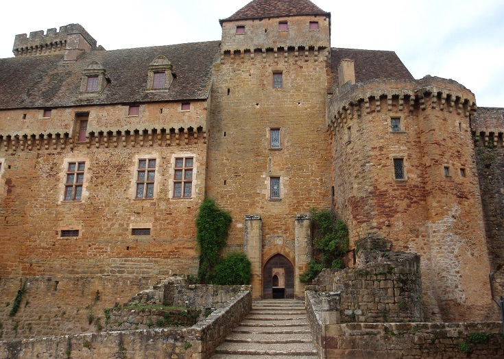
Château de Castelnau-Bretenoux
As you leave Bretenoux and continue on your walk, you’ll reach Château de Castelnau-Bretenoux, a thirteenth-century fortress where ruling barons kept an eye out for invading armies. The rugged walls and towers of this medieval fortress provide a stark contrast to the delicate, refined architecture of Château de Montal. A climb to the top of the artillery tower will reward you with stunning views over the surrounding countryside.
Guided tours are available and expositions are often held during the summer months. You’ll find tariffs and opening hours on the Château de Castelnau-Bretenoux website.
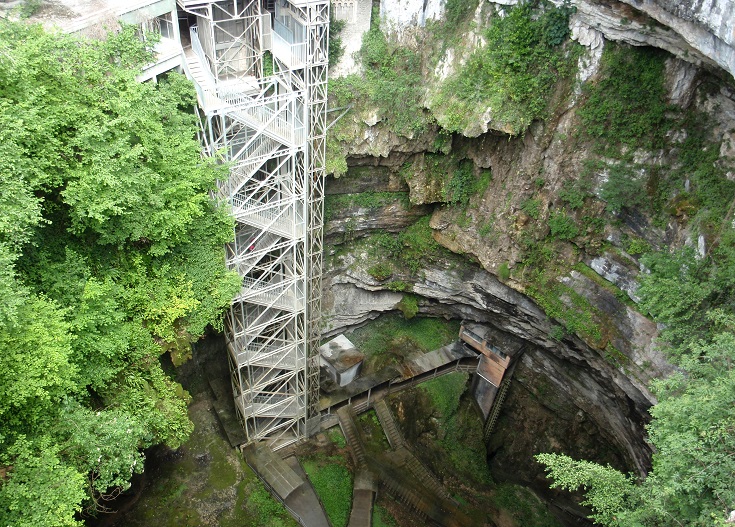
Gouffre de Padirac
Journey deep underground at Gouffre de Padirac
From Loubressac, a variante of the GR 652 walking path offers a shortcut to the next village of Carennac. You could follow it and enjoy a restful day but I recommend continuing along the GR 652 which passes by Gouffre de Padirac—a series of underground lakes and caves 103 metres below the surface.
From Easter until October, a guided tour takes you by boat along an underground river before you disembark and continue on foot past majestic stalagmites and stalactites.
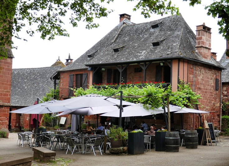
A café in Collonges-la-Rouge offers a pleasant spot for an afternoon drink
Ready to go?
Practical tips for long-distance walking—preparation, packing and avoiding blisters
Purchase the Martel to Rocamadour (PDF) guidebook.
110 pages packed with dozens of photos, taxi phone numbers, links to accommodation websites and train and bus schedules, Tourist Offices, market days, where to find a pharmacy or an ATM, useful French phrases—and many more practical tips!